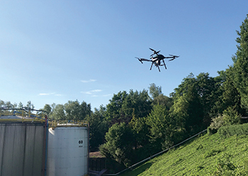
 Strombee scanned the 8-hectare storage tank farm in Belgium in 10 hours over four flights.
Stormbee, a pioneer in mobile mapping solutions, uses unmanned aerial vehicles (UAV) or drones to produce scans of objects, buildings, sites and geological areas seven times faster than would be possible with terrestrial scanners.
Its strong partnership with Faro, a leading global 3D scanning company, has been instrumental in enabling efficient and quick scans of large areas – even entire chemical plants, large factories or open pit mines, Maitham Aloraibi, senior consultant for NorthStar-Faro, tells ABDULAZIZ KHATTAK of Gulf Construction magazine.
“The Faro-Stormbee airborne solution enables wide area scanning missions, such as highways, train infrastructure, and buildings. While these would take days when scanned from the ground, they can now be completed in just hours without interrupting traffic or setting foot on a zone of interest,” he says.
Additionally, he says, this airborne solution further enhances productivity by allowing users to capture complex environments which traditionally would be inaccessible to ground-based scanning and with exceptional levels of accuracy and detail from the air.
Similar to terrestrial scans, aerial scans can achieve an accuracy of up to 1 mm.
The drones come in handy when it comes to scanning huge structures, such as tanks, where you need to scan the top of the tank.
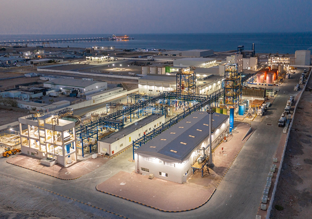
One example of this is the scans done for a client’s storage tank farm for liquids in Antwerp, a port city on Belgium’s River Scheldt. Stormbee was requested to scan the entire eight-hectare site of the facility, which comprises more than 100 tanks, several buildings, roads and railway lines in addition to a shipping terminal owned by the client on the River Scheldt.
“The project presented unique challenges due to the volatile nature of the materials in storage, many of which are used in the petrochemical industry. Additionally, the site is also situated within the controlled zone of Antwerp International Airport,” says Aloraibi.
After having been granted special permission from the relevant aviation authorities, the Stormbee drone Light Detection and Ranging (LiDAR) solution scanned the zone in 10 flights over four hours.
Since the client required all aspects of the site in the CAD model, Stormbee had programmed the flight path to capture scan data from as many angles as possible.
Several areas of the site provided limited access due to chemical or explosive hazards. However, Stormbee has the ability to scan such areas remotely, without endangering people. An accurate 3D CAD model was then produced from the point cloud data.
The advantages in this case included the ability to scan a site in a fraction of the time required using traditional methods and at relatively low costs.
The scans included the tops of storage tanks and difficult-to-access areas between tanks and around the shipping terminal. No ground control points were required for the project.
Another case in point was an aerial survey of a 1-sq-km densely forested area of the Hollymount National Nature Reserve in Northern Ireland, to assess the volume of trees and vegetation and map the underlying topography more accurately.
The challenge, however, was the scant infrastructure such as roads and paths, and the target area is located in an undulating landscape, most of which is densely forested.
“This is a challenge for traditional terrestrial surveying methods due to the size of the area and the limited accessibility,” Aloraibi says.
But Stormbee rose to the challenge here as well, scanning the entire project within a few hours. The processing was completed and the final point cloud data delivered to the client within days.
“The point cloud can be used to make accurate individual distance and volume measurements. The fact that it can also be easily converted to geographical and topographical maps or digital surface models sets it apart from terrestrial surveying methods, photogrammetry or remote sensing,” Aloraibi remarks.
Stormbee here offered same-day post-processing using its in-house software.
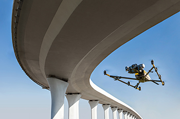
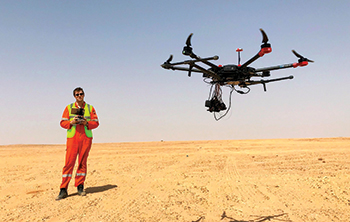
The Stormbee drone measures 145 by 150 by 60 cm when ready for flight and weighs only 15 kg (excluding the scanner) due to its full carbon-fibre frame. It has a flight time of 15 minutes, and can move at speeds from 0 to 15 m/s and at altitudes from 10 to 100 m.
The drone can be operated in varied environments, at temperatures ranging from -5 to 45 deg Celsius and has a wind resistance of 30 kmph.
The Stormbee has been specifically designed for the Faro scanner and is compatible with any Faro terrestrial laser scanner.
The drone incorporates Trimble’s Global Navigation Satellite System (GNSS) for geospatial referencing, while the Faro scanner scans point cloud. Data from the two is then combined using Beeflex, a special software designed by Stormbee. This resulting data can be exported on to any building information modelling (BIM) application available in the market.







.jpg)





 (1).jpg)

